The wall revisited: bulge
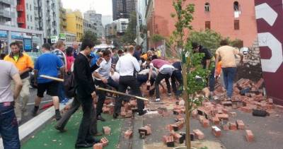
This post has been pieced together rather slowly. It’s the latest and possibly last in a series that began nine years ago, concerning the collapse of a brick wall in Swanston Street one very windy day, March 28th 2013. Three young passersby were killed and others were injured.
In the months following the tragedy there was a palpable feeling out there that someone had to take the blame. There was another line running in some construction-focused forums that sometimes “shit happens” – move on. Given there were so many parties involved, over so many years, the latter argument won by default… though some fines were dished out, focused on the hoarding installation. That’s a little like blaming that last straw for the camel’s broken back.
The hoarding may have been a contributing factor, but over the course of the last few years I’ve come to question whether it was the “final straw”. The wall stood for a quarter century at the edge of a vacant site prone to Melbourne’s gusty winds. The wall stood over 17 months with the hoarding affixed.
The coroner’s findings (without inquest) were published after a five year delay and a change of coroner. It was hardly worth the wait. The findings assumed, without stating why, that the hoarding was the sole culprit and didn’t look beyond it.
Please note before you scroll that some photos were taken just after the collapse and may disturb.
The bulge
I’ve been looking at photographs of the wall for years now – not all the time, maybe a couple of times a year. “New” images turn up occasionally. The Google StreetView images all have a fishbowl quality about them, with many snaps from a moving vehicle stitched together in a way that is otherworldly. Looking at a wall that is on a uneven incline, is covered by an extended hoarding, with wide angle distortion, makes it hard to spot any irregularities in plumbness, but one part of the wall – or the hoarding at least – was looking a bit off from multiple angles.
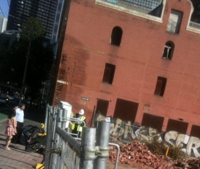
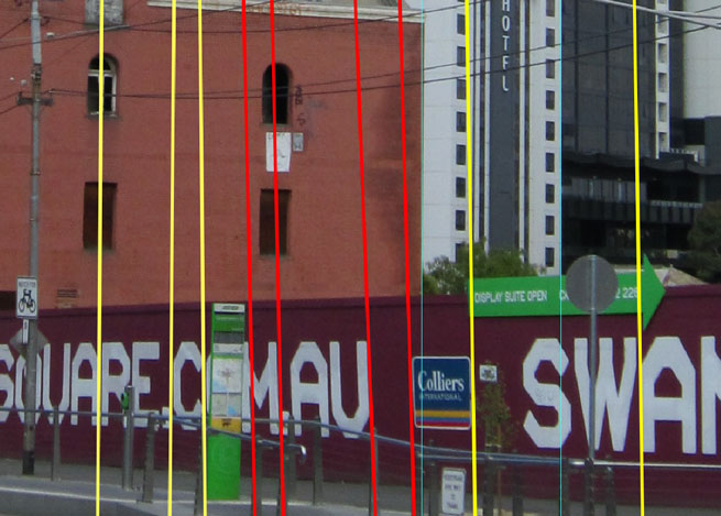
It’s not easy to describe this, but I’ll try, by first adding a string line to Glenn Wilson’s photo taken on February 24th, 2013. Here’s the original image.
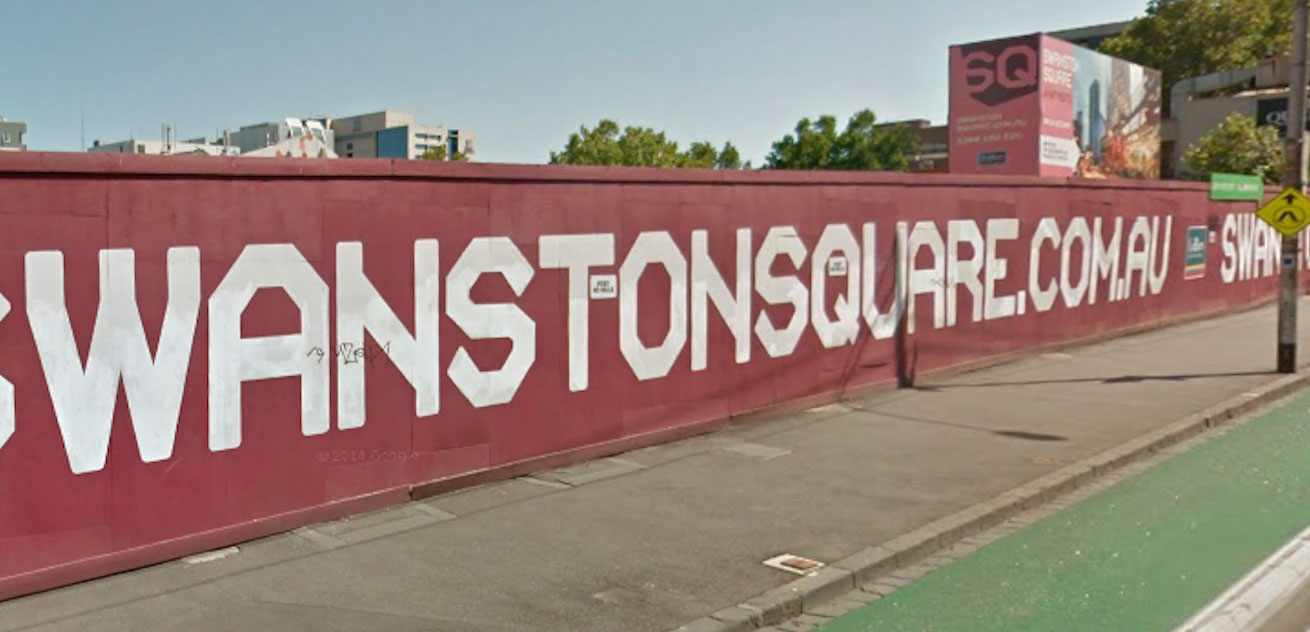
Glenn Wilson 02.13
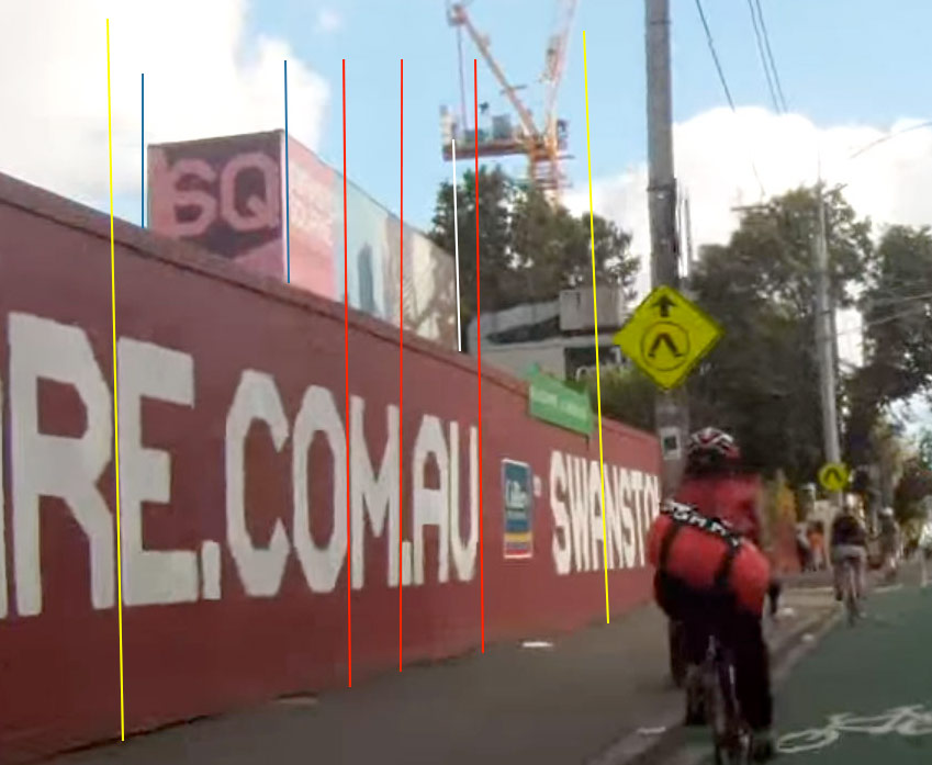
And here’s a zoom with a yellow string line showing, running from one end of the hoarding to the other. It noticeably departs from the wall altogether at the “M.AU” part of the (now defunct) web address.
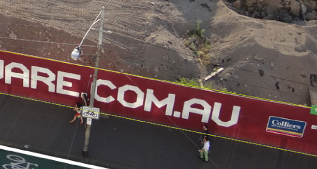
extract from Glenn Smith 02.13
This and other images show the top of the hoarding is not running in a straight line, but in which plane does it veer? It could be moving up and down, which would be okay, or it could be moving in and out, which would not. I think it’s a combination. The land flattens out a tiny bit but the hoarding is also bowing forward. I’m suggesting this because of the way the “M.AU” lettering below slants in different photos. I think this means that those letters aren’t slanted in the plane of the wall so much as out from the wall.
Straight on, the letters “M.AU” come close to lining up with all the others.
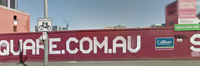
From the front 03.13 (Street View)
Viewed on the oblique from the north, they slant a little to the left.
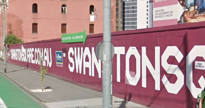
From the north 03.13 (Street View)
From the north 12.12 (extract, Flickr: Neal Jennings )
Viewed from the South, from a cyclecam, they slant to the right.
From the south 23.01.13 (Youtube: tomskiaussie )
From the south 23.01.13 (Youtube: tomskiaussie )
About six weeks after these cyclecam captures this Streetview image was captured, from a similar point of view but a little higher. This was in the month the wall collapsed. The angle seems more pronounced.
From the south 03.13 (Street View)
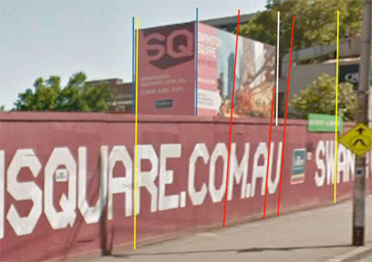
From the south 03.13 (Street View)
It’s hard to tell the degree of tilt. There is little to go off in these photos other than comparison with other photos. Nothing other than the structures in the background can be assumed to be plumb. It looks like the hoarding is most out of whack at around the letter “A” in “AU”.
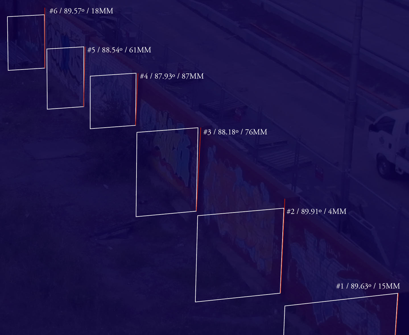
The hoarding was tilting forward but was the brick wall as well? Way back in… April 2013“ I was examining tilt in the brick wall, but at the south end of the wall. A photo from September 2011 was taken from the adjacent Maltstore while the nearby tram “Superstop” was being built. This was just before the hoarding went up.
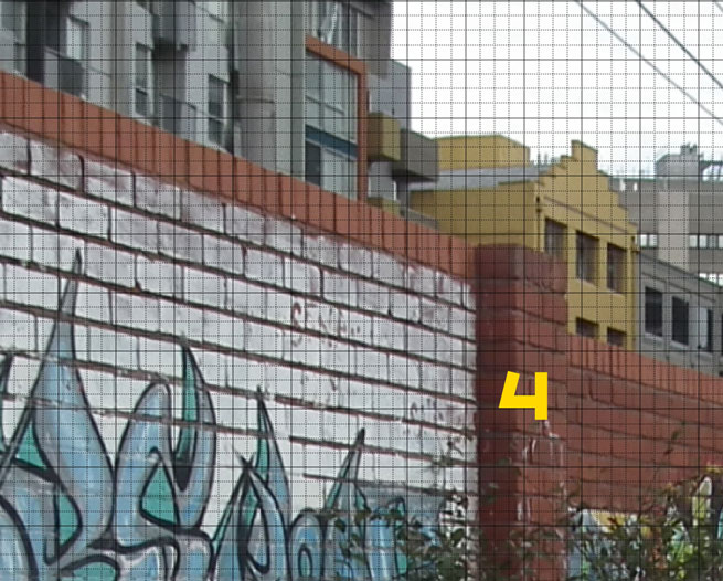
I’ve redone the lens corrections to suit the camera model and applied a perspective grid. The pilaster at point #4 is where “M.AU” was stencilled on the front side, appears more askew than the others.
pilaster labelled #4 (r0k0t7 11.09.11)
numbered columns (extract from r0k0t7 11.09.11)
I measured each column’s angle in the photograph against the vertical, then calculated the horizontal lean over a height of 2.4 metres (the approximate height of the wall). The results are meaningless in absolute terms but meaningful when the columns are compared.
Column 4 is the most out of whack. It could be leaning forward by the thickness of a brick at the top.
I next looked at some photos taken on Christmas Day 2010 and could not find any variation in tilt between the pilasters. Column 4 is pretty much vertical, though Column 5 is a little wider at the top than at the bottom – but then we know it was a badly built wall.
pilaster labelled V (r0k0t7 25.12.10)
The wall was pushing out at column four, but why? Right behind the wall at this point stood a small tree and pilaster (a pier with little if any structural role).
A growing problem
The tree was more an unloved and overgrown shrub – from close inspection of the photos it looks like a dwarf Lilly Pilly. It grew next to the wall in the fill where a cellar used to be, just inside the wall at the point of maximum bulge, right next to the pilaster I’ve called Column 4.
From small beginnings in around 2006 the shrub had grown a good deal in the two years before the collapse – it had risen to within about eight courses from the top of the wall, with equivalent root growth.
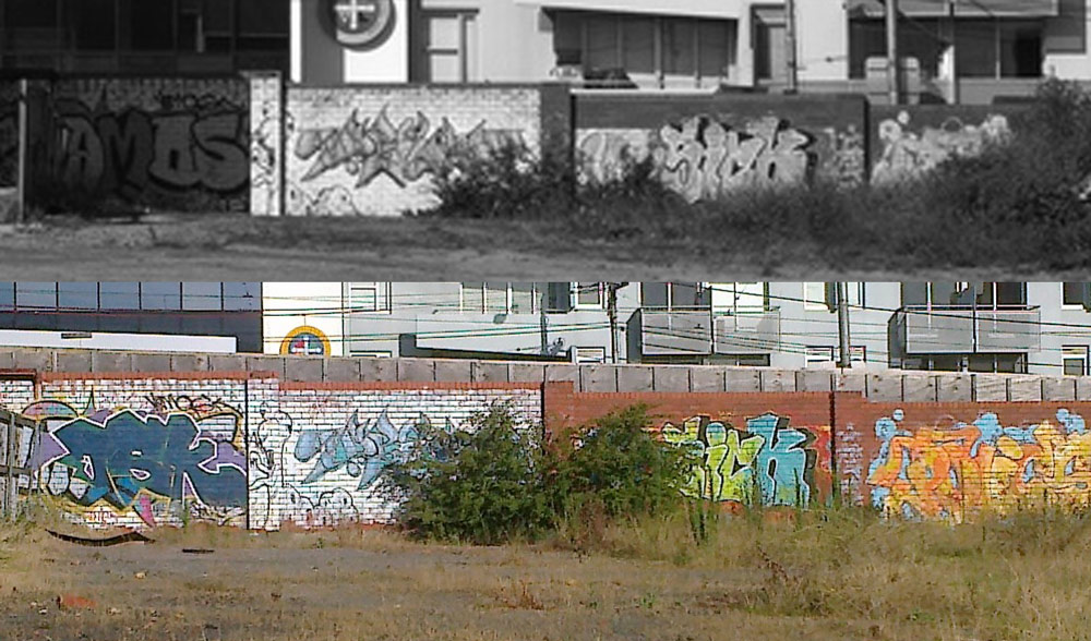
Wurster 9.11 / Anon. 01.13
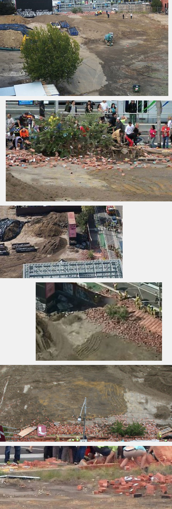
The shrub was a sad mess after the collapse, with broken branches and roots covered in bricks. But it remained standing. There is a series of photos of it at Getty (click the image to see the full set at Getty).
Embed from Getty Images
Zooming in on one of those images allows some observations.
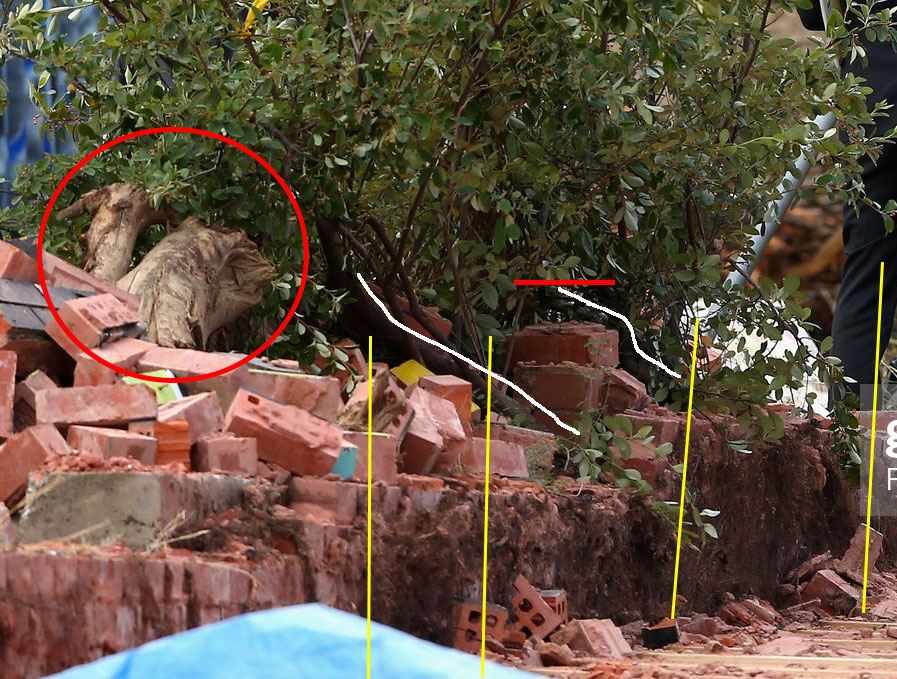
- yellow lines along vertical courses (approximate given the dirt), indicate that the base of the wall was not vertical near the tree
- the trunk (lower white line) appears to emerge from the intersection between the pilaster (red line) and the wall – it looks more to have grown out of the wall than beside it
- a second white line suggests a second trunk on the other side of the pilaster – other photos suggest there were two separate shrubs growing out of the base of the wall
- in this area there’s a lot of thick dirt (including root hair) between the two skins of the brick wall – skins that at the top of the wall were touching
- fragments of another, much larger, dead tree are deposited next to the tree (red circle)
The berm
From the western side of the wall more foreign fragments can be seen, apparently pushed towards the tree some time prior to the collapse, along with dirt and debris.
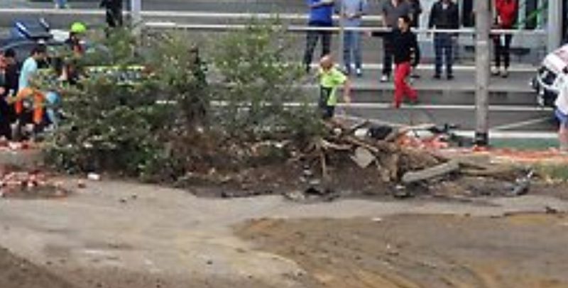
Soon after the collapse, from the west
Once people started throwing bricks into this area, it becomes easier to see the shape of this berm. It might be up to a metre high.
a few minutes later, from the west
from the west, showing large foreign tree trucks or roots
Dirt mounds
Excavations from the archaeological dig zone were dumped near the brick wall early in February 2013. The mounds were about the same height as the wall and were as close as they could be to it, with the angle of repose tapering down to almost touch it.
The mounds were still being removed around the time of the wall collapse on March 28th. It’s not really possible to scrape the ground clean when a shrub is in the way, so tailings and stray logs appeared to be packed into the base of the shrub, perhaps awaiting closer attention with different machinery.
I have not been able to corroborate or verify the following received information, which I’m told was presented at a coronial hearing. Early on the morning of March 28th a helicopter hovered briefly over the site. It diverted there because of a fire alarm going off nearby. Someone on board took footage that included the area behind the wall.
“Footage was obtained from one of the media outlets from a chopper up that morning re: a fire alarm I think at the buildings opposite. The dirt is clearly visible. The entire way along the wall.” source
By the time of the 2:58pm collapse most of it had been cleared.
Whether the removal of earth mounds close to the wall took place on the same day or a few before, it remains a factor in the events of the 28th, but It wasn’t mentioned in the coroner’s summary. Apparently there was uncertainty that there were mounds on this part of the site at all, though numerous photos saying they were. As to the fire alarm, all I could find was this.
a fire callout somewhere on Swanston Street before dawn, 28.03.13
Here are two aerial photos taken during February. Swanston Street and the wall run along the top of the photos, and the shrub is near the top centre, causing there to be a slight indentation in the mounds running along the side of the wall.
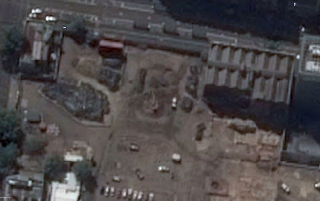
February 8th, 2013 (Google Earth)
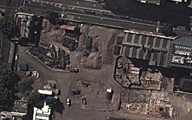
February 24th, 2013 (Google Earth)
Those mounds were very close, if not quite touching the brick wall.
February 2013, tree at lower far right (Glenn Wilson)
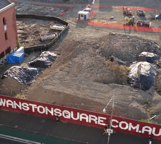
The following set of images were all taken on the day by news photographers. The mounds are mostly gone and the soil near the wall looks recently scraped and hosed (though it had rained early in the day).
March 28th, 2013, after 3pm (news sources).
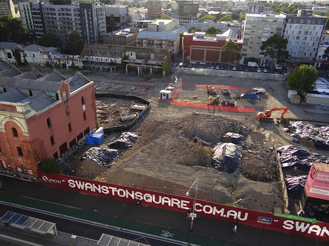
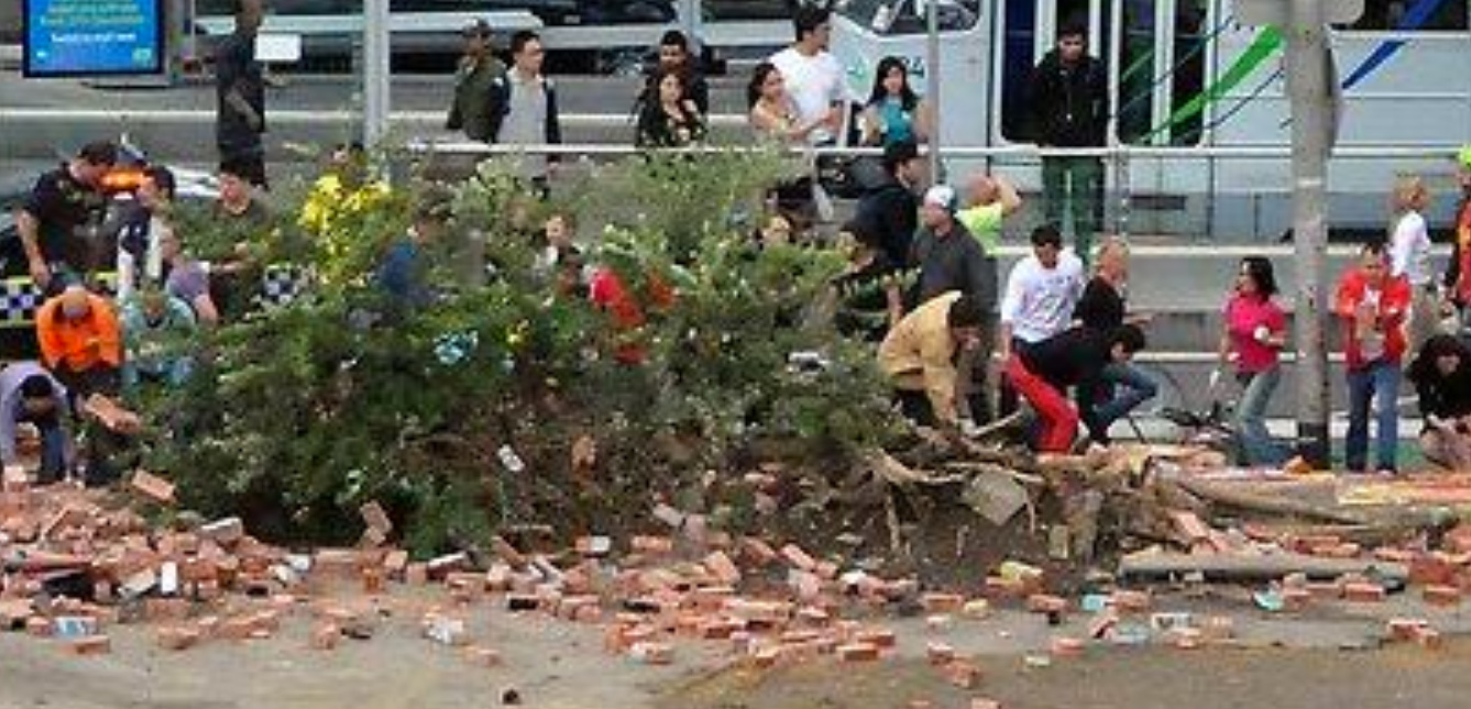
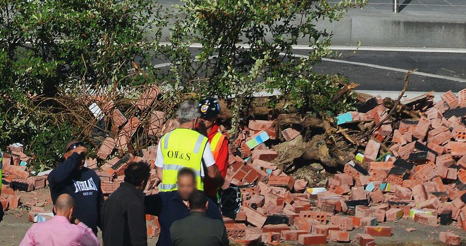
Demolition
The collapse was the result of multiple contributing failures. A thorough investigation of the site was not possible. The entire length of the wall, including the unaffected northern stretch, was demolished that same evening. I have heard that the council authorised the demolition under an emergency order, and the bricks were transported to a site in Melbourne’s north.
Knowing what the individual physical failures were and how they were interrelated was the job of forensic engineers, who did investigate… I’m not sure when or how. If there was a report, it has not been made public.
Findings and omissions
The coroner’s findings without inquest focused solely on the hoarding and its lack of a building permit. There is no examination of the wonky wall or the major earthworks taking place behind the wall. The court relied too heavily on an investigation by WorkSafe, who were mainly interested in the details of the hoarding erection. This narrow focus seeps into and dominates the coroner’s findings. I think the findings miss the mark.
Rather than being a consideration of all circumstances which might form part of a narrative culminating in the death, [a coronial investigation] is confined to those circumstances which are sufficiently proximate and causally relevant to the death.”
Coroner’s findings – Bridget L. Jones – 4 June 2018
Edits: 10.04.22 minor grammatical edits and clarification of conclusion.
Posted by Peter on 03.04.22 in authorities
tags: archaeology, brick, demolition, developers, safety, swanston street wall
comment
Commenting is closed for this article.